Enter your details to sign in
Don’t have an account?
Sign upOr you can sign in with
a single account for all
STIR platforms
All your bookmarks will be available across all your devices.
Stay STIRred
Already have an account?
Sign inOr you can sign up with
Verification link sent to check your inbox or spam folder to complete sign up process



We use cookies and similar technologies, to help provide you with a better, faster, and safer experience while delivering content
tailored to your interests.
By clicking on the AGREE button, closing this banner, clicking or navigating the website, you consent to the use of all cookies and similar technologies for the purposes we describe in our
Privacy Policy.
We use several cookies that are related to the functionality, security & user preferences,
analytics, and advertising. While some are essential, you may choose to dis-allow the use of others.
Please choose your preference, or opt for the best experience by closing this banner, clicking or navigating the website.
For more detailed information please read our Privacy Policy
 Connect
Connect
Connect





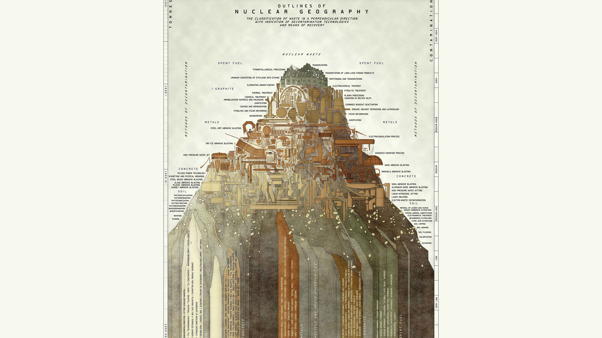
Outlines of Nuclear Geography is an infographic illustration of nuclear waste materials forming the silhouette of a mountain and stacking upon each other following two hierarchies of volume and radioactive contamination. The elevation further annotates a number of different decontamination technologies and potential reuse projects. The elevation of a mountain is a direct response to the design of deterrence markers (such as The Landscape of Thorns or Spike Field by Michael Brill), which employ archetypes to signal an invisible nuclear threat hidden underground.
This illustration engages in a similar approach, but in reverse. The mountain stands for an archetype of eminence, abundance and presence. It does not signal an invisible threat, rather the threat is visualized, classified and exposed in all its matters, as a tangible issue that can and should be addressed.



 Sign in with Google
 Sign in with email